Menu
Flagstaff, Arizona
HOG HILL TRAIL


DETAILS

Directions:

From Flagstaff, take W. Old Route 66 to Woody Mountain Road (FR 231). Turn left. Follow Woody Mountain Road approximately 14 miles to FR 538. Turn right on FR 538 and continue approximately 3.5 miles to FR 538G. Take the left fork to Dorsey Spring Trailhead.

Equipment:

  • Sturdy hiking shoes
  • extra water
  • food/snacks
  • camera

Hike Info:

The trail is difficult to follow at times.  It is best to copy the trail map and use in conjunction with a GPS.

This trail does not offer any vista or views. To access the trail, park at the intersection of Forest Service road 538G and 538E. Hike down 538E until you reach the trailhead of Hog Hill and Dorsey Spring Trails. Hog Hill is to the left.


Hike down the wide path for about 1 mile. After this point, the trail gets very difficult to follow. It is important to download this route to follow or, as I did, use Google Map terrain The Hog Hill Trail can be seen and marked on Google. I took this trail from Kelsey Spring Trail and up to the trailhead as part of a loop hike. Once past this difficult section through open terrain and downed trees, you’ll re-enter the forest continuing downhill. At the end of the trail is the Winter Cabin Trail and the Kelsey Spring Trail. Hike down a little further, and you’ll reach a primitive cabin. It makes for good shelter but doesn’t look great for winter use.


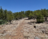
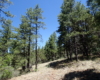
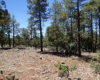
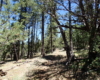
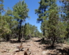
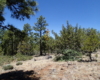
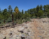
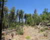
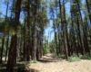
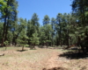
Below is a loop hike that includes the Hog Hill Trail:

Create Routes
or Search for a route
from millions at MapMyHike
Post Views: 335