
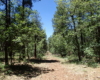
DORSEY SPRINGS TRAIL
Adventure Travel
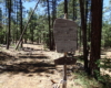
| DETAILS
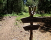
Directions: From Flagstaff, take W. Old Route 66 to Woody Mountain Road (FR 231). Turn left. Follow Woody Mountain Road approximately 14 miles to FR 538. Turn right on FR 538 and continue another 3.5 miles to FR 538G. Take the left fork to Dorsey Spring Trailhead. Equipment:
Hike Info: From the parking area the trail has a steep descent to the Spring. Trail is well maintained. |


Below is a loop hike that include Dorsey Spring Trail: